I think one of the main reasons why we come to Tenerife or move here is the extraordinary beauty of this place. Locations where high mountains meet the sea are always attractive. Tenerife is a paradise for hiking enthusiasts, with many great trails of varying levels of difficulty.
Afur - Taganana - Afur circular route
Today, I would like to talk about one of such routes in the Anaga Mountains in the northeast of the island. It’s a circular route that allows you to return to the starting point. I first hiked this trail in December 2021. On AllTrails, the route is marked as “difficult” and according to the app, it is 11.9 km long with an average completion time of 4 hours and 23 minutes. In my case, the loop ended up being a bit longer, 13.5 km (probably because I veered off the trail towards the end), while my time was a bit shorter at exactly 4 hours. In my opinion, the route wasn’t very difficult; I’ve hiked much more challenging trails on Tenerife, such as the shortest trail from Realejo Alto to Asomadero (“Devil’s Stairway” as my daughter named it 🙂 ). However, I must note that all the times I hiked it, the weather was good and it wasn’t raining. There are signs along the trail warning against crossing streams during rain—I’ve witnessed what can happen in a canyon during a downpour in another location…
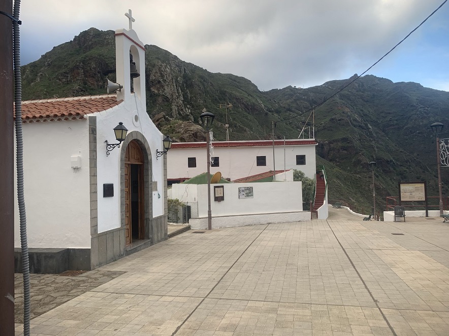
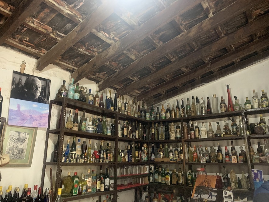
The route starts and ends in the tiny mountain village of Afur, located in the Anaga Mountains. The village center is situated at an elevation of 366 meters above sea level. You can reach Afur, for example, from La Laguna (20 km, 39 minutes). The road is quite winding but in good condition. In the village, just below the church, there is a large parking lot where you should have no trouble leaving your car. I’ve parked there twice, and both times there was plenty of space. At the top of Afur, there is a small bar-shop where you can, for instance, enjoy a coffee. It’s a place worth visiting for its decor and atmosphere. The shop is run by an elderly man with whom we would definitely disagree on political and historical matters… ¡No pasarán!
Small settlement of Afur. Photo by: Dominik Piskorski
An interior of a shop / coffe bar in Afur. Photo by: Dominik Piskorski
Interior of coffe shop in Afur. I definitely don't share political sympathies of the owners. Photo by: Dominik Piskorski
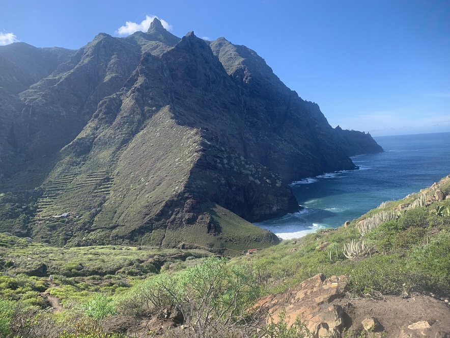
Going down to the Playa de Tamadiste
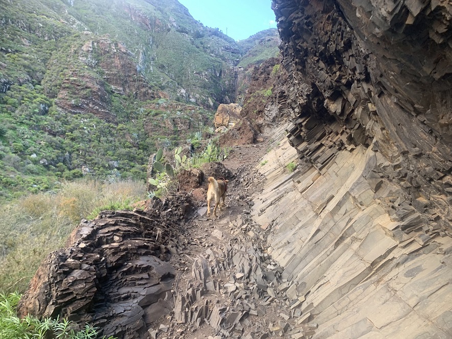
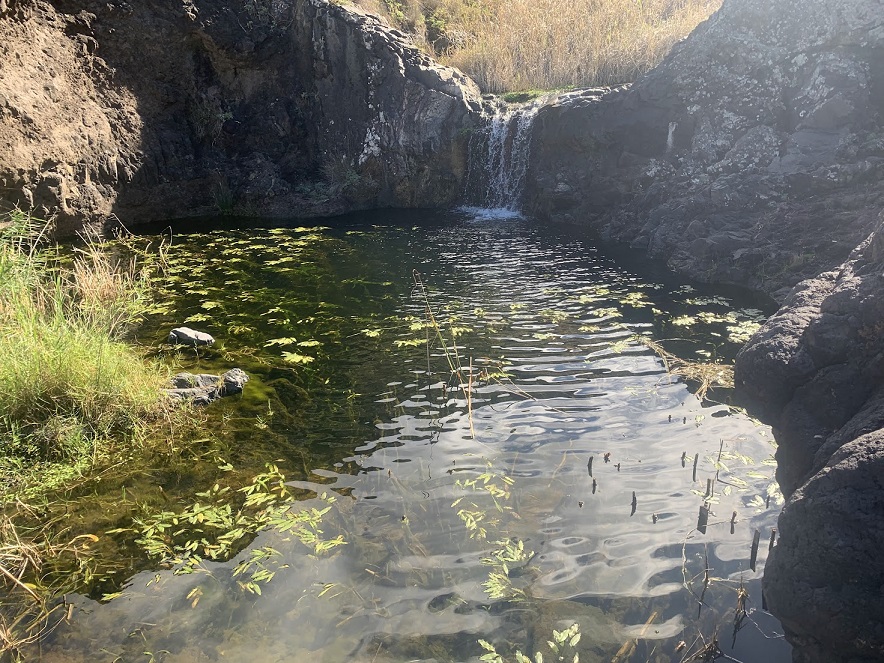
Since the route is circular, you can do it in either direction. I’ve hiked it twice, both times heading towards Playa de Tamadiste, which means descending from the parking lot. When I went, the trail was well-marked. For most of the way, the path toward the ocean runs along the slopes of a large gorge (barranco). Along the way, you can admire interesting rock formations. At certain points, you cross a narrow stream, which under normal conditions can be done without getting your feet wet.
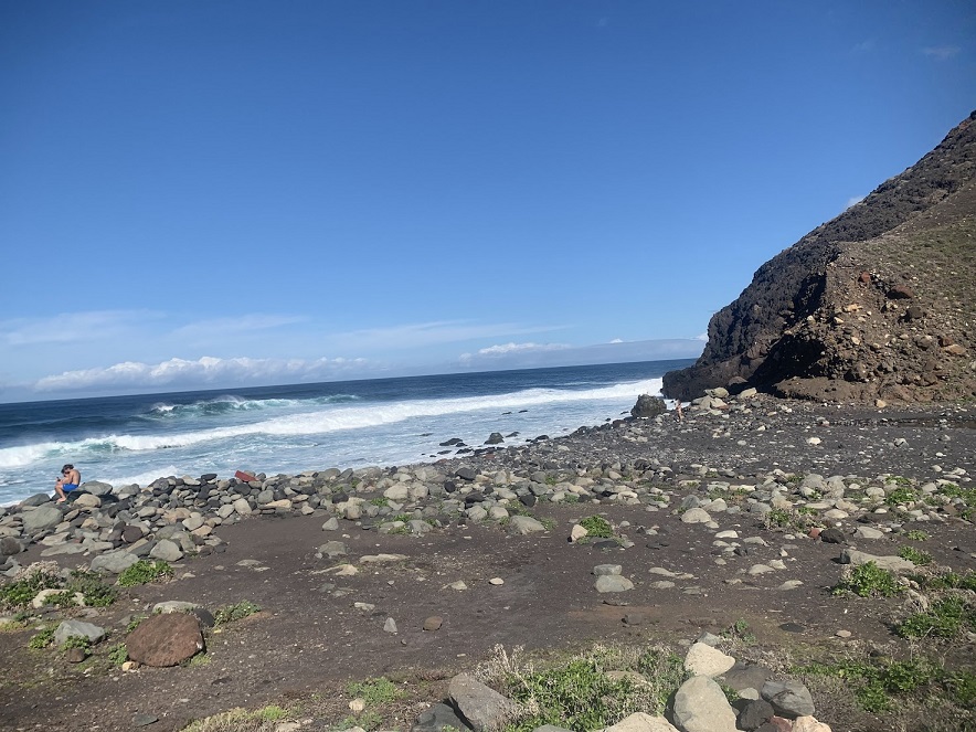
It takes about 45 minutes to reach Playa de Tamadiste. The beach is made of pebbles, and both times I was there during high tide with large waves, so I didn’t swim. However, I’ve seen photos of the beach at low tide, revealing nice sand.
Going down to Playa de Tamadiste. Photo by: Dominik Piskorski
Looking back to direction of Afur. Photo by: Dominik Piskorski
The stream along the Barranco de Afur. Photo by: Dominik Piskorski
From Playa de Tamadiste to Taganana
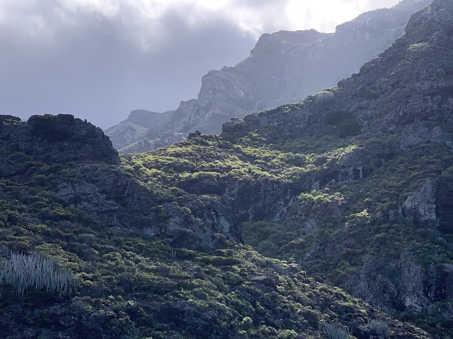
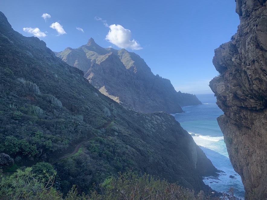
After a short rest on the beach, it’s time to continue. From here, there’s no choice but to head uphill. The first ascent is quite exhausting, but once you reach the top, the view back towards Playa de Tamadiste more than compensates for the effort. The entire stretch from the beach to the tiny village of El Chorro, where you reach a paved road, offers absolutely stunning views—this is the highlight of the route.
For a while, the trail runs along a road, though you’ll rarely encounter cars on it. As you head towards Afur, you’ll pass by Taganana—the actual village lies below the trail. If you have the time and energy, it’s definitely worth descending. In Taganana, you’ll find cafes, restaurants, and shops. It’s a very charming village.
The return from Taganana to Afur is also scenically appealing, though after the breathtaking views from the previous section, you might feel slightly desensitized to them.
Playa de Tamadiste. Photo by: Dominik Piskorski
The views from the route to Taganana are stunning. Photo by: Dominik Piskorski
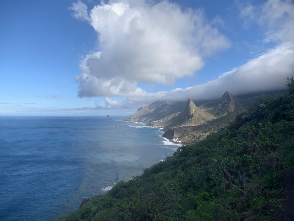
The views in Taganana direction. Far away is Benijo beach. Photo by: Dominik Piskorski
Return from Taganana to Afur
At the very end, just before reaching Afur, you need to walk about a kilometer along an asphalt road. On one hand, it’s a pity that the entire loop can’t be done on hiking paths, but on the other hand, your legs get a bit of a rest. It’s a good idea to plan the hike in such a way that you leave Anaga before dark. I once had to drive back from Taganana to La Laguna after dusk, right when the clouds rolled in—I wouldn’t recommend it to anyone. Overall, the entire route is excellent.